Recall from section 4.2.1 - Climate is the average weather pattern of a certain area, and it is what determines the BIOME an area is divided into. Mainly, it's based on annual rainfall and temperature variations. These conditions determine which plants can grow, and thus which animals can occupy the area.
You probably already know some biomes just by thinking about them - hot/wet = the rainforest, hot/dry = desert. There are more that we need to discuss because knowing the different biomes and their characteristics is vital to their protection and management, and all life on Earth. The major ones you need to know are discussed below:
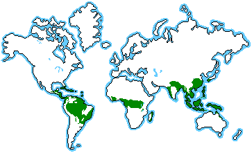
Equatorial
Also known as tropical rainforests, these are usually located along the equator as shown in the graphic below:
The
latitude usually comes under the Doldrums Low Pressure belt all the year and
therefore there are almost
no distinct seasons. The
midday sun is always near the vertical and it is overhead twice a year, at the
equinoxes. Average
daily temperatures are typically at around 26.9°C (80.3°F) throughout the year.
Extensive cloud cover and heavy rainfall prevent diurnal temperatures from
rising much over 33°C (91.4°F.) Rainfall
is heavy and is usually convectional.
Here is a typical climatogram for an equatorial biome:

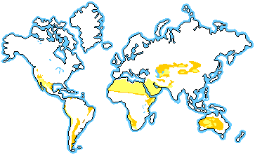
Tropical Desert
Tropical deserts are usually found in the the sub-tropics, as shown on the map below.
They are hot, and they typically have exceptionally hot periods of the year. In
many locations featuring a hot desert climate, maximum temperatures of 40°C to
45°C (113 F) are not uncommon in summer. During
colder periods of the year, night-time temperatures can drop to freezing or
below due to the exceptional radiation loss under the clear skies; however,
very rarely do temperatures drop far below freezing. They are typically dry year-round.
Here is a typical climatogram for a tropical desert biome:
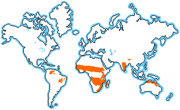
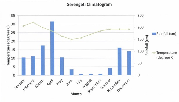
Savanna
Savanna biomes are usually found in the outer regions of the tropical zones, as shown on the map below.
Tropical
savanna climates have monthly mean temperature above 18°C (64 F) in every month of the
year and typically a pronounced dry season, with the driest month having
precipitation less than 60 mm. In
essence, a tropical savanna climate tends to either see less rainfall than a
tropical monsoon climate or have more pronounced dry seasons.
Here is a typical climatogram for a savanna biome:
Monsoon
Monsoon biomes are shown on the map below.

Tropical
monsoon climates have monthly mean temperatures above 18°C (64 F) in every month of
the year and feature wet and dry seasons,
as Tropical savanna
climates do. Also like tropical savanna climates, a tropical monsoon climate's driest month
sees less than 60 mm of precipitation but will always have some level of precipitation even in that month. A tropical monsoon climate tends to see less variance in temperatures during
the course of the year than a tropical savanna climate. This
climate has a driest month which nearly always occurs at or soon after the
"winter" solstice for that side of the equator. There is often yearly major flooding events in monsoon biomes, most notably in India, due to the extreme wet season caused by a change in wind pattern. For more detail on this, read about monsoons here.
Here is a typical climatogram for a monsoon biome:

Warm Temperate
Warm temperate biomes lie between the tropics and polar regions, as shown on the map below (green areas).
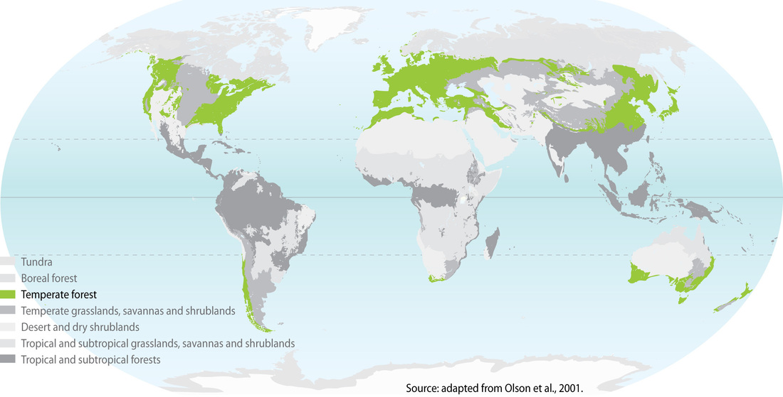
The changes in warm temperate biomes between summer and winter are generally relatively moderate, rather than extreme hot or cold. There are usually 4 seasons and is home to most of world’s human population. In certain areas, such as Asia and central North America, the variations between summer and winter can be extreme because these areas are far away from the sea, causing them to have a continental climate. In regions traditionally considered tropical, localities at high altitudes (e.g. parts of the Andes) may have a temperate climate. It's not overly rainy or dry, thus the temperate description.
Here is a typical climatogram for a warm temperate biome:
Sub-Arctic
The sub-arctic biomes are between 50-70 degrees latitude North on large landmasses, as shown in the map below.
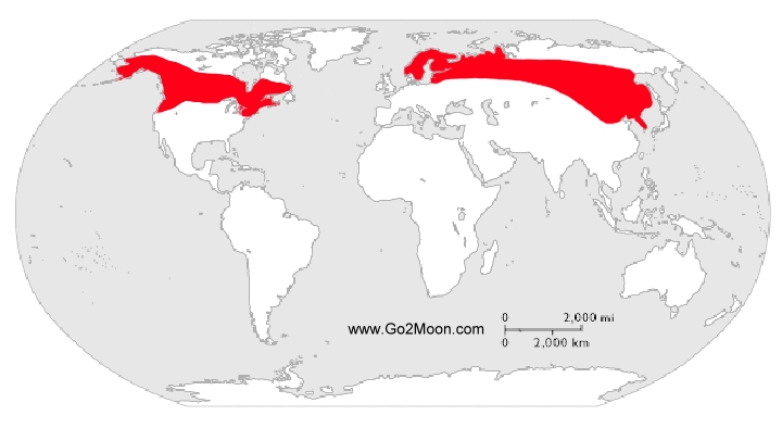
The Sub-Arctic Biome is characterized
by long, usually very cold winters, and short, cool to mild summers. Most
subarctic climates have very little precipitation, typically no more than 15
inches (380 mm) over an entire year. Vegetation in
regions with subarctic climates is generally of low diversity, as only hardy
species can survive the long winters and make use of the short summers.
Here is a typical climatogram for a Sub-Arctic Biome:

We will get into more detail of the major Biomes, and even add some more, in the Biosphere unit.
No comments:
Post a Comment